Ingleton Waterfalls Trail
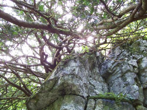
- Location: Ingleton Waterfalls Trail, North Yorkshire
- Date Taken (dd-mm-yy): 09/08/07.
This old Yew tree (Taxus baccata) was perched on a rocky overhang. Although it's roots definately penetrate the rock, and will cause cracks susceptible to freeze-thaw action, and the angular jointing of the rock (including the underside of one bedding plane) is well portrayed, I also added it because I'm very happy with the way the picture came out! I must have been having one of my Arty moments again.
- Login or register to post comments
 Send to friend

This work is licensed under a Creative Commons Attribution-No Derivative Works 2.5 License.
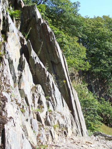
- Location: Ingleton Waterfalls Trail, North Yorkshire.
- Date Taken (dd-mm-yy): 09/08/07
Only a few tens of metres downstream from Baxenghyll Gorge, is this outcrop of steeply inclined slate of the Ingletonian Series. It is most probably Baxenghyll Slate.
- Login or register to post comments
 Send to friend

This work is licensed under a Creative Commons Attribution-No Derivative Works 2.5 License.
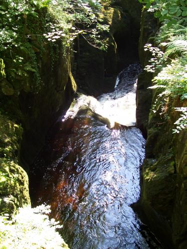
- Location: Ingleton Waterfalls Trail, North Yorkshire.
- Date Taken (dd-mm-yy): 09/08/07.
Baxenghyll Gorge again, looking down stream to the South West.
- Login or register to post comments
 Send to friend

This work is licensed under a Creative Commons Attribution-No Derivative Works 2.5 License.
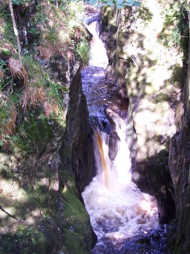
- Location: Ingleton Waterfalls Trail, North Yorkshire.
- Date Taken (dd-mm-yy): 09/08/07.
Baxenghyll Gorge on the River Doe. This shot is looking up stream to the North East.
- Login or register to post comments
 Send to friend

This work is licensed under a Creative Commons Attribution-No Derivative Works 2.5 License.
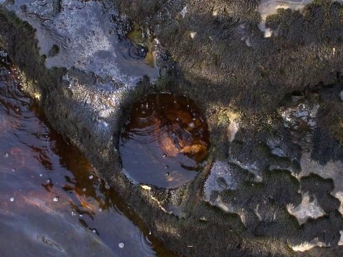
- Location: Ingleton Waterfalls Trail, North Yorkshire.
- Date Taken (dd-mm-yy): 09/08/07.
This picture is pretty much self explanatory. A deep pot hole worn into the river bed. Again sorry for my lack of scale, the hole is approximately 1&1/2ft in diameter.
- Login or register to post comments
 Send to friend

This work is licensed under a Creative Commons Attribution-No Derivative Works 2.5 License.
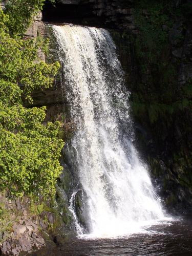
- Location: Ingleton Waterfalls Trail, North Yorkshire.
- Date Taken (dd-mm-yy): 09/08/07.
- Login or register to post comments
 Send to friend

This work is licensed under a Creative Commons Attribution-No Derivative Works 2.5 License.
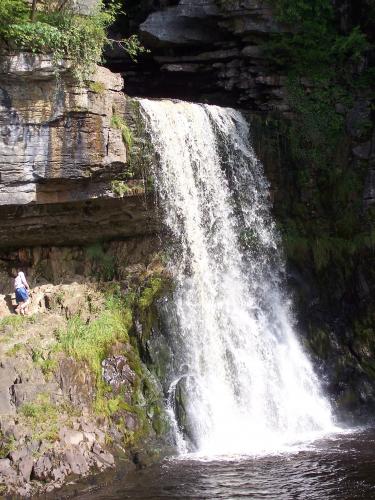
- Location: Ingleton Waterfalls Trail, North Yorkshire.
- Date Taken (dd-mm-yy): 09/08/07.
This is Thornton Force. The gent in the photo was some random rambler, hippy looking bloke. (If he didn't want to be in my picture he should have moved out of the way.) However, his presence does illustrate the scale of the falls well.
- Login or register to post comments
 Send to friend

This work is licensed under a Creative Commons Attribution-No Derivative Works 2.5 License.
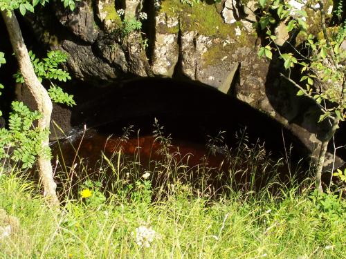
- Location: Ingleton Waterfalls Trail, North Yorkshire.
- Date Taken (dd-mm-yy): 09/08/07.
This feature, just above Hollybush Spout, is very similar to the depression shown on the previous picture. Although it looks like a man-made culvert, it is in fact completely natural - in the gloom beneath the arch there is smooth solid, albeit concave, rock worn by the force of water when the river is in flood.
- Login or register to post comments
 Send to friend

This work is licensed under a Creative Commons Attribution-No Derivative Works 2.5 License.
- Location: Ingleton Waterfalls Trail, North Yorkshire.
- Date Taken (dd-mm-yy): 09/08/07.
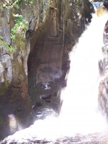
Hollybush Spout, another of the waterfalls on the River Twiss, over Pre-Carboniferous strata of the Ingletonian Series. I've included this picture to highlight the concave structure to the left of the falls in the picture. I don't know if this particular feature has a name, but it appears to be worn only when the river is at peak (possibly even flood) flow.
- Login or register to post comments
 Send to friend

This work is licensed under a Creative Commons Attribution-No Derivative Works 2.5 License.
- Location: Ingleton Waterfalls Trail, North Yorkshire.
- Date Taken (dd-mm-yy): 09/08/07.
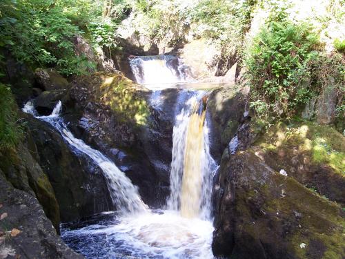
This is the first of the second set of pictures, taken whilst following the Ingleton Waterfalls Trail. This is Pecca Falls on the River Twiss, descending over Pre-Carboniferous slates of the Ingletonian Series. As I posted on a previous photo, this site provides a pretty respectable overview of the geology of the area.
- Login or register to post comments
 Send to friend

This work is licensed under a Creative Commons Attribution-No Derivative Works 2.5 License.
 GeologyRocks