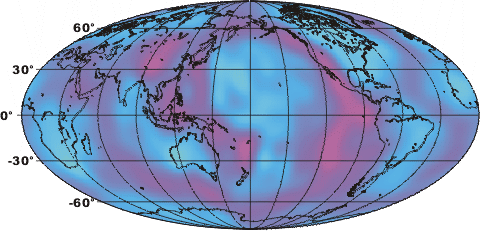
Diagram :: Tomographic Map
- Drawn By: Jon Hill
- Description: Tomographic map of the upper mantle. This image was constructed using the velocity of seismic waves as they pass through the Earth. Slow areas are hot (pink), while faster areas are cold (blue). You can clearly see the spreading ridges in the Pacific and Atlantic, along with the volcanisms associated with the ring of fire.
- Date(DD-MM-YYYY): 26-03-2006